https://sputniknews.in/20230113/isro-satellite-images-suggest-entire-joshimath-could-go-under-the-ground-486965.html
ISRO Satellite Images Suggest All of Joshimath Could Go Under the Ground
ISRO Satellite Images Suggest All of Joshimath Could Go Under the Ground
Sputnik India
Joshimath town in Uttarakhand's Chamoli district was declared a sinking zone and locals were evacuated after deep cracks surfaced in houses and roads due to... 13.01.2023, Sputnik India
2023-01-13T12:28+0530
2023-01-13T12:28+0530
2023-01-13T12:40+0530
india
uttarakhand
joshimath
sinking land
natural disaster
the himalayas
indian space research organisation (isro)
https://cdn1.img.sputniknews.in/img/07e7/01/0d/487838_0:142:2728:1677_1920x0_80_0_0_f19cab4e593d9d8715675d58ac4e5891.jpg
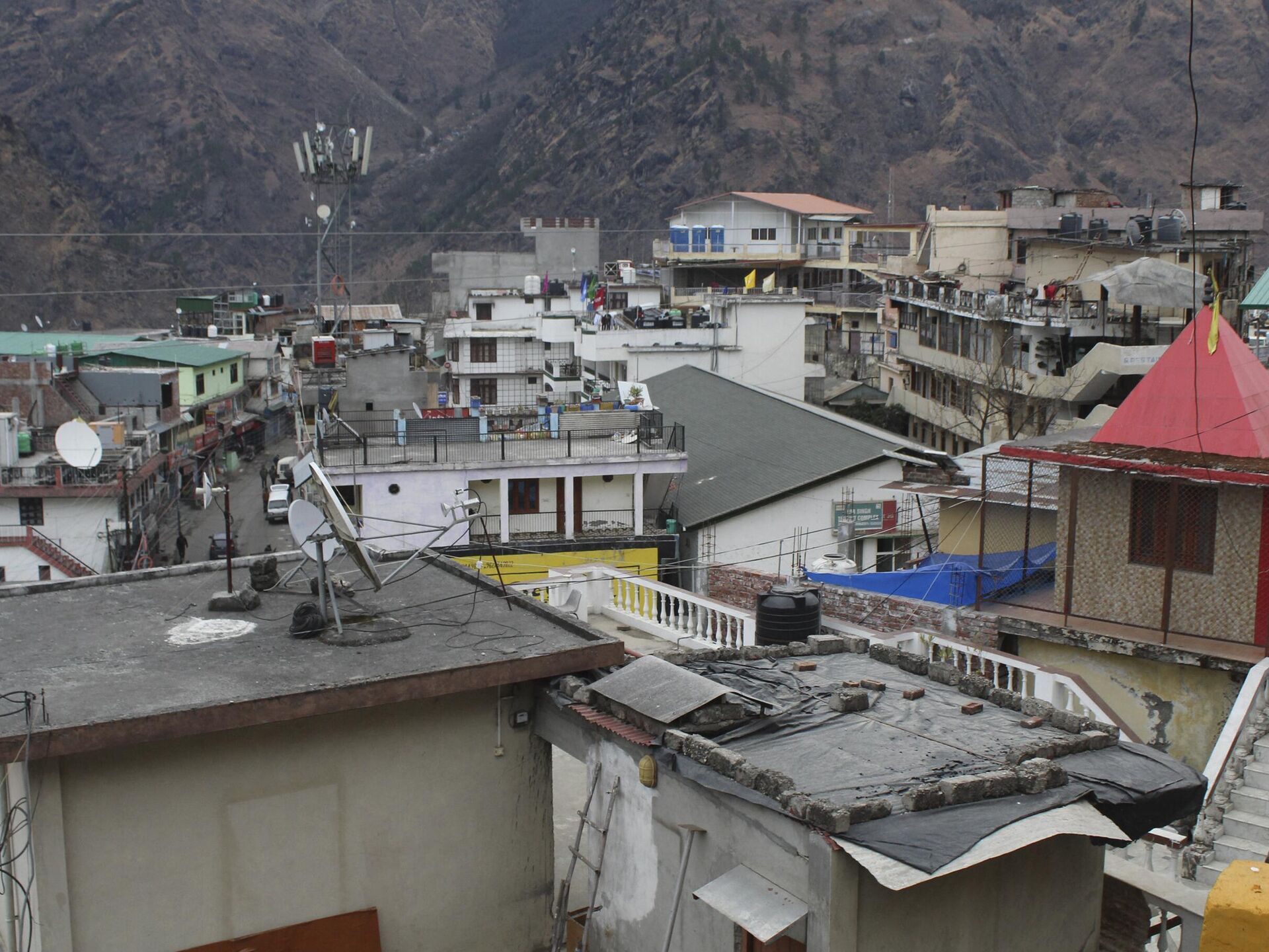
Satellite images of the sinking Joshimath released by the Indian Space Research Organization's National Remote Sensing Centre show that rapid land subsidence of 5.4 centimeters was recorded in 12 days — between December 27, 2022, and January 8, 2023.The subsidence zone is located in central Joshimath, including the Army Helipad and Narsingh Mandir, while the crown of the subsidence is located near the Joshimath-Auli road, at a height of 2,180 meters.From April to November 2022, Joshimath saw a slow subsidence of 9 centimeters.Sinking Crisis in Joshimath On December 24, Joshimath locals shut down shops and took to the streets to protest against the lack of action on the part of the authorities regarding the risky situation in the area and demanded that they cease construction projects in the town.Reports about Joshimath "sinking" made headlines last week, after cracks appeared in around 678 buildings, prompting the Chamoli district administration to declare the town a land-subsidence zone.A total of 81 families, around 4,000 people, have been moved to safer areas. While the administration has distributed food kits and blankets to the affected families, the government announced an interim relief package of INR 150,000 ($1,843).Last week, the district administration, officials from the Central Building Research Institute (CBRI), and the disaster management team announced plans to demolish a number of local buildings that developed deep cracks and were at high risk of collapsing. While several scientists and engineers have been roped in to analyze the occurrence of the sinking Joshimath, some people blame tunneling work for a hydel project by the National Thermal Power Corporation Limited (NTPC). However, the NTPC issued a statement, saying the tunnel is not passing under Joshimath, so it could not be blamed for the land subsidence.What is Joshimath Famous For?Joshimath was built on the slopes of old landslides. It became famous as the place where religious reformer Adi Shankaracharya attained enlightenment in the eighth century.Situated just 50 km away from India's border with China, Joshimath is a gateway to highly revered religious Hindu shrines Badrinath and Hemkund Sahib, and to a number of Himalayan mountain climbing expeditions and trekking trails.
https://sputniknews.in/20230111/residents-raise-alarm-over-sinking-of-three-indian-communities-455307.html
india
uttarakhand
joshimath
the himalayas
Sputnik India
feedback.hindi@sputniknews.com
+74956456601
MIA „Rossiya Segodnya“
2023
Sangeeta Yadav
https://cdn1.img.sputniknews.in/img/07e6/0c/0f/110602_0:0:641:640_100x100_80_0_0_c298016a79eb02ef8caa9d1f688c12a5.jpg
Sangeeta Yadav
https://cdn1.img.sputniknews.in/img/07e6/0c/0f/110602_0:0:641:640_100x100_80_0_0_c298016a79eb02ef8caa9d1f688c12a5.jpg
News
en_IN
Sputnik India
feedback.hindi@sputniknews.com
+74956456601
MIA „Rossiya Segodnya“
Sputnik India
feedback.hindi@sputniknews.com
+74956456601
MIA „Rossiya Segodnya“
Sangeeta Yadav
https://cdn1.img.sputniknews.in/img/07e6/0c/0f/110602_0:0:641:640_100x100_80_0_0_c298016a79eb02ef8caa9d1f688c12a5.jpg
satellite images of joshimath sank 5.4 cm in 12 days, indian space research organization's national remote sensing centre, sinking joshimath town, rapid land subsidence, sinking crisis joshimath
satellite images of joshimath sank 5.4 cm in 12 days, indian space research organization's national remote sensing centre, sinking joshimath town, rapid land subsidence, sinking crisis joshimath
ISRO Satellite Images Suggest All of Joshimath Could Go Under the Ground
12:28 13.01.2023 (Updated: 12:40 13.01.2023) Joshimath town in Uttarakhand's Chamoli district was declared a sinking zone and locals were evacuated after deep cracks surfaced in houses and roads due to land subsidence.
Satellite images of the sinking Joshimath released by the Indian Space Research Organization's National Remote Sensing Centre show that rapid land subsidence of 5.4 centimeters was recorded in 12 days — between December 27, 2022, and January 8, 2023.
The subsidence zone is located in central Joshimath, including the Army Helipad and Narsingh Mandir, while the crown of the subsidence is located near the Joshimath-Auli road, at a height of 2,180 meters.
From April to November 2022, Joshimath saw a slow subsidence of 9 centimeters.
Sinking Crisis in Joshimath
On December 24, Joshimath locals shut down shops and took to the streets to protest against the lack of action on the part of the authorities regarding the risky situation in the area and demanded that they cease construction projects in the town.
Reports about Joshimath "sinking" made headlines last week, after cracks appeared in around 678 buildings, prompting the Chamoli district administration to
declare the town a land-subsidence zone.
A total of 81 families, around 4,000 people, have been moved to safer areas. While the administration has distributed food kits and blankets to the affected families, the government announced an interim relief package of INR 150,000 ($1,843).
Last week, the district administration, officials from the Central Building Research Institute (CBRI), and the disaster management team announced plans to demolish a number of local buildings that developed deep cracks and were at high risk of collapsing.
While several scientists and engineers have been roped in to analyze the occurrence of the sinking Joshimath, some people blame tunneling work for a hydel project by the National Thermal Power Corporation Limited (NTPC).
However, the NTPC issued a statement, saying the tunnel is not passing under Joshimath, so it could not be blamed for the land subsidence.
What is Joshimath Famous For?
Joshimath was built on the slopes of old landslides. It became famous as the place where religious reformer Adi Shankaracharya attained enlightenment in the eighth century.
Situated just 50 km away from India's border with China, Joshimath is a gateway to highly revered religious Hindu shrines Badrinath and Hemkund Sahib, and to a number of Himalayan mountain climbing expeditions and trekking trails.


