https://sputniknews.in/20240104/india-advances-high-altitude-platform-systems-for-border-surveillance--military-6088412.html
India Advances High Altitude Platform Systems for Border Surveillance & Military
India Advances High Altitude Platform Systems for Border Surveillance & Military
Sputnik India
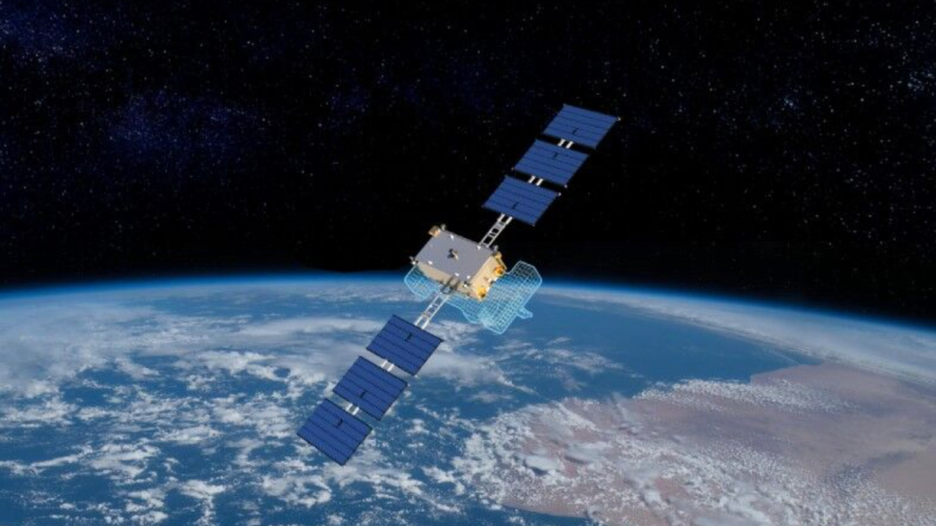
India is moving closer to deploying High Altitude Platform Systems (HAPS), or solar-powered "pseudo-satellites". During the winter solstice flight tests, the indigenous prototype stayed aloft for 21 hours, marking a major milestone, media reports.
2024-01-04T20:27+0530
2024-01-04T20:27+0530
2024-01-04T20:27+0530
defenсe news
science & tech
india
bengaluru
indian air force (iaf)
government of india
ministry of defence (mod)
ministry of external affairs (mea)
space satellite
drone
https://cdn1.img.sputniknews.in/img/07e8/01/04/6092020_0:23:1200:698_1920x0_80_0_0_99b856bd05a0c01c6ba12b3aed737405.png
India is moving closer to deploying High Altitude Platform Systems (HAPS), or solar-powered "pseudo-satellites". During the winter solstice flight tests, the indigenous prototype stayed aloft for 21 hours, marking a major milestone, media reports.It is part of India's Wingman drone programme, which is expected to make its first flight in 2024. HAPS works much like a remotely piloted aircraft, bridging the gap between satellites orbiting the earth and the drone operating in the atmosphere by flying at an altitude of 65,000 feet in the stratosphere.Their solar-powered propulsion and stratospheric range allow them to hover for months at a time, above all weather and air traffic.The HAPS prototype was developed by Bengaluru-based startup NewSpace Research and Technologies Pvt. Ltd. as part of the Indian Ministry of Defence's Innovation for Defence Excellence (iDEX) programme. NewSpace Research and Technologies CEO Sameer Joshi announced the major milestone at X.“HAPS is a strategic asset and a cross between a satellite and an aeroplane; with the endurance of a satellite and the agility of an aircraft for a persistent stratospheric presence. A must-have for India to augment the large gap between the demand and supply of ISR (Intelligence Surveillance and Reconnaissance) and communication data by a multitude of military and civilian users and agencies”, Sameer Joshi, a former fighter pilot in the Indian Air Force (IAF), told the media.What are High Altitude Pseudo-Satellites?High Altitude Pseudo Satellites, or HAPS platforms, are one of the latest aerospace technologies to gain popularity. These disruptive technologies have the potential to completely transform space activities. While these unmanned stratospheric vehicles have been researched since the 1990s, recent technological developments have taken the latest versions to more advanced levels in terms of operations, payloads and capabilities.HAPS are very useful for communication in remote areas with no infrastructure or in the deep sea. Other areas where HAPS can provide useful services include precision agriculture, smart city management, disaster relief and search and rescue (SAR) missions.How Can the Military Benefit From High-Altitude Pseudo-Satellites?With a coastline of 7,516.6 km and a long, complicated land border of approximately 15106.7 km, protecting India's borders is vital and requires a variety of approaches. HAPS, which hovers at the edge of the Earth's atmosphere, can help with effective border surveillance by detecting movements far into hostile territory or in the deep sea.The current gaps in satellite services can be filled by a network of HAPS. HAPS would be essential for coordinating strike missions, communicating with troops stationed in remote areas, and providing Battle Damage Assessment (BDA) through real-time video feeds and imagery - which were lacking during the Balakot strikes and raised doubts about the mission's viability - to assess the mission's effectiveness and determine the best course of action.
https://sputniknews.in/20240103/pakistan-air-force-introduces-new-combat-uavs-as-modernization-plans-unfold-6077675.html
india
bengaluru
Sputnik India
feedback.hindi@sputniknews.com
+74956456601
MIA „Rossiya Segodnya“
2024
Swapna Nair
https://cdn1.img.sputniknews.in/img/07e7/09/12/4320104_0:0:681:681_100x100_80_0_0_ca8a7d4d582609272840ffdd1cde7278.jpg
Swapna Nair
https://cdn1.img.sputniknews.in/img/07e7/09/12/4320104_0:0:681:681_100x100_80_0_0_ca8a7d4d582609272840ffdd1cde7278.jpg
News
en_IN
Sputnik India
feedback.hindi@sputniknews.com
+74956456601
MIA „Rossiya Segodnya“
Sputnik India
feedback.hindi@sputniknews.com
+74956456601
MIA „Rossiya Segodnya“
Swapna Nair
https://cdn1.img.sputniknews.in/img/07e7/09/12/4320104_0:0:681:681_100x100_80_0_0_ca8a7d4d582609272840ffdd1cde7278.jpg
india, high-altitude platform systems (haps), indigenous, drone wingman, aircraft, earth-orbiting satellites, propulsion and stratospheric, high-altitude long endurance (hale), cost of surveillance, usaf reaper class drone, newspace research and technologies pvt. ltd, indian ministry of defense, innovation for defence excellence (idex), ceo of newspace research and technologies, isr (intelligence surveillance and reconnaissance), indian air force (iaf), high altitude pseudo satellites, unmanned aerial vehicles (uavs), beyond line of sight (blos), search and rescue (sar), battle damage assessment (bda)
india, high-altitude platform systems (haps), indigenous, drone wingman, aircraft, earth-orbiting satellites, propulsion and stratospheric, high-altitude long endurance (hale), cost of surveillance, usaf reaper class drone, newspace research and technologies pvt. ltd, indian ministry of defense, innovation for defence excellence (idex), ceo of newspace research and technologies, isr (intelligence surveillance and reconnaissance), indian air force (iaf), high altitude pseudo satellites, unmanned aerial vehicles (uavs), beyond line of sight (blos), search and rescue (sar), battle damage assessment (bda)
India Advances High Altitude Platform Systems for Border Surveillance & Military
India has achieved a milestone with solar-powered High Altitude Platform Systems, also known as pseudo-satellites, which operate at 65,000 feet to enhance border surveillance and military operations. Sputnik India examines the significance and military potential of HAPS.
India is moving closer to deploying High Altitude Platform Systems (HAPS), or solar-powered "pseudo-satellites". During the winter solstice flight tests, the indigenous prototype stayed aloft for 21 hours, marking a major milestone, media reports.
It is part of India's Wingman drone programme, which is expected to make its first flight in 2024. HAPS works much like a remotely piloted aircraft, bridging the gap between satellites orbiting the earth and the drone operating in the atmosphere by flying at an altitude of 65,000 feet in the stratosphere.
Their solar-powered propulsion and stratospheric range allow them to hover for months at a time, above all weather and air traffic.
When comparing a "pseudo-satellite" to a High-Altitude Long Endurance (HALE) drone such as the Reaper, the cost of surveillance is significantly reduced. A HAPS-class vehicle costs less than $500 per hour to operate, while a USAF Reaper-class drone costs over $3500 per hour.
The HAPS prototype was developed by Bengaluru-based startup NewSpace Research and Technologies Pvt. Ltd. as part of the Indian Ministry of Defence's Innovation for Defence Excellence (
iDEX) programme. NewSpace Research and Technologies CEO Sameer Joshi announced the major milestone at X.
“HAPS is a strategic asset and a cross between a satellite and an aeroplane; with the endurance of a satellite and the agility of an aircraft for a persistent stratospheric presence. A must-have for India to augment the large gap between the demand and supply of
ISR (Intelligence Surveillance and Reconnaissance) and communication data by a multitude of military and civilian users and agencies”, Sameer Joshi, a former fighter pilot in the Indian Air Force (IAF), told the media.
What are High Altitude Pseudo-Satellites?
Unmanned aircraft operating in the stratosphere at altitudes of around 65,000 feet or higher are known as high-altitude pseudo-satellites. These solar-powered aircraft are intended to bridge the gap between traditional satellites in space and unmanned aerial vehicles (UAVs) operating at lower altitudes. These long-endurance flights, which can last for months or even years while a satellite remains stationary, can provide flexible alternatives for Intelligence, Surveillance and Reconnaissance (ISR), removing the limitations of satellite performance and capabilities.
High Altitude Pseudo Satellites, or HAPS platforms, are one of the latest aerospace technologies to gain popularity. These disruptive technologies have the potential to completely transform space activities. While these unmanned stratospheric vehicles have been researched since the 1990s, recent technological developments have taken the latest versions to more advanced levels in terms of operations, payloads and capabilities.
Compared to traditional satellites, which are more difficult to launch, HAPS are much cheaper to develop and launch. Beyond Line of Sight (BLOS) technology allows remote control of these vehicles. HAPS are mainly used for telecommunications and remote sensing applications in the military and commercial sectors.
HAPS are very useful for communication in remote areas with no infrastructure or in the deep sea. Other areas where HAPS can provide useful services include precision agriculture, smart city management, disaster relief and
search and rescue (SAR) missions.
According to research by the European Space Agency, HAPS can create "secure communication bubbles" to provide "emergency communications and broadband internet services" for major events such as the Olympics.
How Can the Military Benefit From High-Altitude Pseudo-Satellites?
With a coastline of 7,516.6 km and a long, complicated land border of approximately 15106.7 km, protecting India's borders is vital and requires a variety of approaches. HAPS, which hovers at the edge of the Earth's atmosphere, can help with effective border surveillance by detecting movements far into hostile territory or in the deep sea.
Equipped with advanced sensors and high-resolution optical and infrared cameras, these airborne platforms are suitable for missions requiring round-the-clock coverage, border patrol, target tracking, maritime surveillance and navigation, and even missile detection.
The current gaps in satellite services can be filled by a network of HAPS. HAPS would be essential for coordinating strike missions, communicating with troops stationed in remote areas, and providing Battle Damage Assessment (BDA) through real-time video feeds and imagery - which were lacking during the Balakot strikes and raised doubts about the mission's viability - to assess the mission's effectiveness and determine the best course of action.


